Aging infrastructure
Conservative, static line ratings leave usable capacity stranded on lines that could safely carry far more.
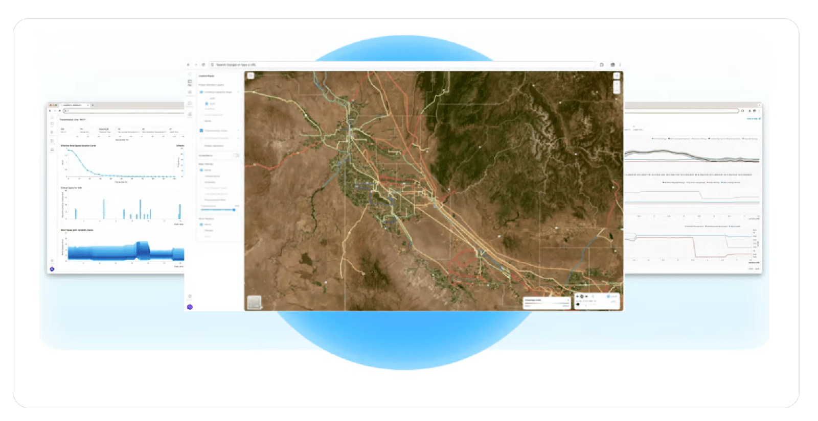
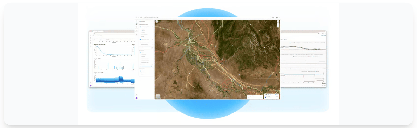
Span-level, statistical forecasts for dynamic line rating, wildfire risk, system reliability, and more — paired with a drone that puts sensors and line solutions directly onto energized power lines.
Working across
Utilities are asked to move more power across infrastructure that was built decades ago — while wildfire seasons grow longer and weather turns less predictable. The hardest part isn't knowing there's a problem. It's getting real, span-by-span data from the line itself.
Conservative, static line ratings leave usable capacity stranded on lines that could safely carry far more.
A single hot, dry, windy span can ignite a catastrophe. Crews need to see risk before conditions turn dangerous.
Weather models stop at the regional level. Decisions happen at the span — and that's exactly where the data was missing.
Outages cost money and trust. Birds alone account for more than 30% of outages — and can start fires.
WireWeather™ applies probabilistic forecasting and analytics directly to the network — turning scalable weather data into operational decisions. Instead of a single regional number, utilities get statistical confidence at the resolution that matters: the individual span.
Software, sensors, hardware, and the only drone designed to work hands-on with energized power lines — built to operate together.
Statistical forecasting and analytics applied to the grid: dynamic line rating, wildfire risk, and system reliability — all streamed to cloud software your operators already trust.
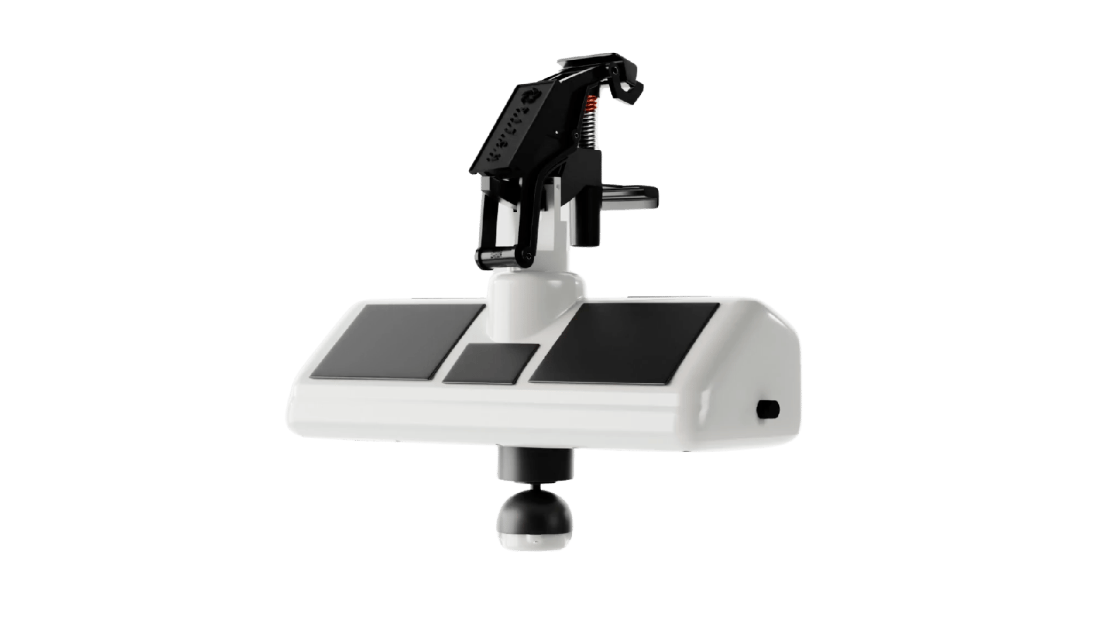
High-precision weather monitoring hardware that clamps onto power lines and streams live conditions back to WireWeather™. Deployed on energized lines by the Pitch installation drone.
Line markers that eliminate up to 90% of bird collisions. Birds account for more than 30% of outages and can ignite wildfires — FeatherFender™ keeps lines visible and habitats safe.
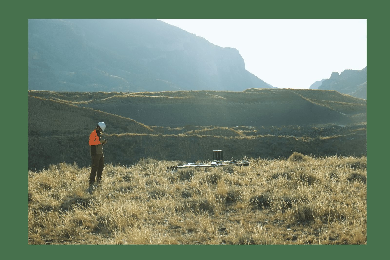
Our custom drone places sensors and line solutions directly onto energized power-line cables and towers — and performs up-close inspections no crew can match.
The installation drone places WireWarrior™ sensors and FeatherFender™ markers directly onto energized lines and towers — no outage required.
Sensors continuously measure real conditions at the span and stream them to WireWeather™ in the cloud for statistical forecasting.
Utilities push more power through existing lines, prevent wildfires, cut outages, and prioritize maintenance with confidence.
Reduction of bird collisions with FeatherFender™ line markers
Of outages caused by birds — a leading, preventable risk
Payload our drone places in contact with an energized cable
Founded in Boise, Idaho — aviation & aerospace from day one
Founded in 2016 and headquartered in Boise, Idaho, Pitch Aeronautics brings aviation and aerospace engineering to one of the world's most critical pieces of infrastructure: the electric grid.
Our methodology is simple and rigorous — get real instruments onto the line, capture statistically meaningful data, and turn it into forecasts utilities can act on. By combining purpose-built flight hardware with probabilistic weather intelligence, we help operators safely unlock capacity, harden against wildfire, and improve reliability without rebuilding the network from scratch.
Drone-installed markers now protect high-traffic avian crossings, targeting up to 90% fewer collisions on enrolled spans.
Read the briefOperators can now see probabilistic capacity headroom per span, unlocking more throughput on existing lines.
Read the briefNew deployments bring WireWarrior™ sensors to high-risk regions ahead of a hotter, drier outlook.
Read the briefPitch Aeronautics is proud to be supported by partners who believe in a smarter, safer, higher-capacity grid.
Tell us about your network. We'll show you how span-level intelligence and drone-deployed line solutions can boost capacity and cut risk.